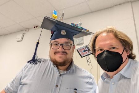
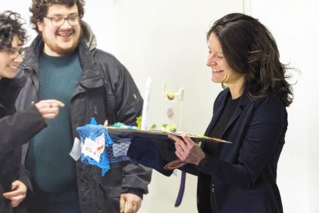
Paper published:

Positioning possibilities for human geographies of the sea
This paper positions possibilities for human geographies of the sea. The growing volume of work under this banner has been largely qualitative in its approach, reflecting, in turn, the questions posed by oceanic scholars. These questions necessitate corresponding methods. Whilst this is not necessarily a problem, and the current corpus of work has offered many significant contributions, in making sense of the human dimensions of maritime worlds, other questions —and methods—may generate knowledge that is useful within this remit of work. This paper considers the place of quantitative approaches in posing lines of enquiry about shipping, one of the prominent areas of concern under the banner of ‘human geographies of the seas’. There is longstanding work in transport geographies concerned with shipping, logistics, freight movement and global connections, which embraces quantitative methods which could be bridged to ask fresh questions about oceanic spatial phenomena past and present. This paper reviews the state of the art of human geographies of the sea and transport geographies and navigates how the former field may be stimulated by some of the interests of the latter and a broader range of questions about society‐sea‐space relations. The paper focuses on Automatic Identification Systems (or AIS) as a potentially useful tool for connecting debates, and deepening spatial understandings of the seas and shipping beyond current scholarship. To advance the argument the example of shipping layups is used to illustrate or rather, position, the point.

Paper published:

Sustainability
Many of the global challenges that confront humanity are interlinked in a dynamic complex network, with multiple feedback loops, nonlinear interactions and interdependencies that make it difficult, if not impossible, to consider individual threats in isolation. These challenges are mainly dealt with, however, by considering individual threats in isolation (at least in political terms). The mitigation of dual climate and biodiversity threats, for example, is linked to a univariate 1.5°C global warming boundary and a global area conservation target of 30% by 2030. The situation has been somewhat improved by efforts to account for interactions through multidimensional target setting, adaptive and open management and market-based decision pathways. But the fundamental problem still remains—that complex systems such as those formed by the network of global threats have emergent properties that are more than the sum of their parts. We must learn how to deal with or live with these properties if we are to find effective ways to cope with the threats, individually and collectively. Here, we argue that recent progresses in complex systems research and related fields have enhanced our ability to analyse and model such entwined systems to the extent that it offers the promise of a new approach to sustainability. We discuss how this may be achieved, both in theory and in practice, and how human cultural factors play an important but neglected role that could prove vital to achieving success.

Paper published:

Unsupervised pattern and outlier detection for pedestrian trajectories using diffusion maps
The movement of pedestrian crowds is studied both for real-world applications and to gain fundamental scientific insights into systems of self-driven particles. Trajectory data describes the dynamics of pedestrian crowds at the level of individual movement paths. Analysing such data is a central challenge in pedestrian dynamics research, coupled with increasing data availability this implies a need for efficient methods to identify key features of the captured crowd dynamics. In this paper, we show that diffusion maps, an unsupervised manifold learning method, can be used for this purpose. We show how to build an informative feature space by defining a set of observables from trajectories. We use our diffusion map approach to analyse pedestrian movement on a stadium-shaped track, and during egress from a room, considering hundreds of trajectories for each scenario. We first verify that our diffusion map analysis can recover known leading variables that determine the system dynamics. Then, we show how our analysis facilitates a qualitative comparison of the dynamics inherent in entire data sets, by contrasting experimental with numerically simulated data. Finally, we establish how our approach can be used to automatically detect outliers that show behaviour distinct to others. These results indicate that our work can contribute a computationally efficient and unsupervised approach to analyse pedestrian dynamics without needing much prior knowledge of the data. We suggest this could be useful for automatically monitoring live data, or as an initial step to inform a subsequent analysis.

Paper published:

Aggregation of monitoring datasets for functional diversity estimation
Long-term monitoring data is central for the analysis of biodiversity change and its drivers. Time series allow a more accurate evaluation of diversity indices, trait identification and community turnover. However, evaluating data collected across different monitoring programs remains complicated because of data discrepancies and inconsistencies. We have proposed a method for aggregating datasets using diffusion maps. The method is illustrated by aggregating long-term phytoplankton abundance data from the Wadden Sea and Southern North Sea gathered by two institutions located in Germany and The Netherlands. The aggregated data allowed us to infer species traits, to reconstruct the main trait axis which drives community functionality, ultimately quantifying functional diversity of the individual samples, having used only the co-occurrence of species in samples. Although functional diversity varies greatly among sampling stations, we detect a slight positive trend in German stations which contrasts with the clear decreasing trend observed in most of the Dutch stations at the West Wadden Sea. Stations at the Terschelling transect, in Southern North Sea, also showed contrasting estimations of functional diversity between off-shore and in-shore stations. Our research provides further evidence that traits and functional diversity can be robustly reconstructed from monitoring data alone, showing that data aggregation can increase the accuracy of this reconstruction, being able to aggregate heterogeneous datasets.